Geolocate

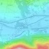
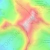
Livigno topographic map

Click on the map to display elevation.

Livigno

Only three roads lead to the town. Two link to Switzerland, one through the Forcola di Livigno, elevation 2,315 m (7,595 ft) and open in summer only, and the second through the Munt la Schera Tunnel. The third road connects to other parts of Italy through the Foscagno Pass, elevation 2,291 m (7,516 ft).

Wikipedia (CC-BY-SA 3.0)

About this map

Name: Livigno topographic map, elevation, terrain.

Location: Livigno, Comunità montana Alta Valtellina, Sondrio, Lombardy, 23041, Italy (46.42106 10.03915 46.62594 10.21910)

Average elevation: 2,388 m

Minimum elevation: 1,412 m

Maximum elevation: 3,255 m

Other topographic maps

Click on a map to view its topography, its elevation and its terrain.
Montespluga

Italy > Lombardy > Sondrio > Madesimo

Montespluga is an Alpine village near the head of the Valle Spluga in the Italian region of Lombardy. It is a frazione of the comune of Madesimo, located at 1,908 m of altitude on the road to Chiavenna.

Average elevation: 2,194 m
Alpi Orobie Occidentali

Italy > Lombardy > Sondrio

Average elevation: 1,226 m

Fiume Adda

Italy > Lombardy > Sondrio > Postalesio > Ca' Spinedi

Average elevation: 358 m

Santa Caterina Valfurva

Italy > Lombardy > Sondrio > Valfurva

Average elevation: 2,148 m

Pizzo Cengalo

Italy > Lombardy > Sondrio > Val Masino

Average elevation: 2,657 m

Santa Caterina

Italy > Lombardy > Sondrio > Valfurva

Average elevation: 2,152 m

Trepalle

Italy > Lombardy > Sondrio > Livigno

Trepalle is a village (the highest in Italy) in the Italian Alps, a frazione of Livigno, Lombardy. It is sometimes considered to be the village located at the highest altitude in Europe with its church located at an altitude of 2,069 m, and the village stretching up to the Passo d'Eira at 2,209 m. However,…

Average elevation: 2,236 m
Codera

Italy > Lombardy > Sondrio > Novate Mezzola

Average elevation: 1,170 m

Monte Cevedale

Italy > Lombardy > Sondrio > Valfurva

Average elevation: 3,301 m

Santa Caterina

Italy > Lombardy > Sondrio > Valfurva

Average elevation: 2,152 m

Pianazzola

Italy > Lombardy > Sondrio > Chiavenna

Average elevation: 780 m

Laresìn

Italy > Lombardy > Sondrio > Chiesa in Valmalenco

Average elevation: 2,121 m

Santa Caterina

Italy > Lombardy > Sondrio > Valfurva

Average elevation: 2,152 m

Trepalle

Italy > Lombardy > Sondrio > Livigno

Trepalle is a village (the highest in Italy) in the Italian Alps, a frazione of Livigno, Lombardy. It is sometimes considered to be the village located at the highest altitude in Europe and is the highest in the European Union with its church located at the Passo d'Eira at 2,209 m (7,247 ft). However, Kurush…

Average elevation: 2,236 m
Val Cedec

Italy > Lombardy > Sondrio > Valfurva

Average elevation: 2,796 m

Savogno

Italy > Lombardy > Sondrio > Borgonuovo

Average elevation: 1,101 m

Rosette

Italy > Lombardy > Sondrio > Castione Andevenno

Average elevation: 539 m

Maranta

Italy > Lombardy > Sondrio > Stazzona

Average elevation: 895 m

Franchesi

Italy > Lombardy > Sondrio > Teglio

Average elevation: 689 m

Chiareggio

Italy > Lombardy > Sondrio > Chiesa in Valmalenco

Average elevation: 2,081 m

Forbicina

Italy > Lombardy > Sondrio > Chiesa in Valmalenco

Average elevation: 2,104 m

Cà dé Vedùc

Italy > Lombardy > Sondrio > Chiuro > Dalico

Average elevation: 1,272 m

Colda

Italy > Lombardy > Sondrio > Sondrio > Mossini

Average elevation: 569 m

Gear up for your next adventure:

🥾Walking Shoes - Lightweight walking shoes for countryside and coastal paths
🧭Orienteering Compasses - Accurate compasses for map-based navigation
🍱Food Containers - Reusable containers for outdoor meals
🧼Camping Hygiene Kits - Compact hygiene essentials for outdoor stays
🧥Packable Down Jackets - Lightweight warmth that compresses small in your bag

As an Amazon Associate, this site earns from qualifying purchases at no extra cost to you.