
Thank you for supporting this site ❤️
Make a donation
Make a donation
Gear up for your next adventure:
As an Amazon Associate, this site earns from qualifying purchases at no extra cost to you.
Wakro topographic map
Click on the map to display elevation.
Thank you for supporting this site ❤️
Make a donation
Make a donation
Gear up for your next adventure:
As an Amazon Associate, this site earns from qualifying purchases at no extra cost to you.
About this map
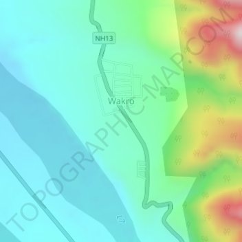
Name: Wakro topographic map, elevation, terrain.
Location: Wakro, Wakro Circle, Lohit district, Arunachal Pradesh, India (27.77121 96.34408 27.78625 96.35475)
Average elevation: 466 m
Minimum elevation: 324 m
Maximum elevation: 917 m
Thank you for supporting this site ❤️
Make a donation
Make a donation
Gear up for your next adventure:
As an Amazon Associate, this site earns from qualifying purchases at no extra cost to you.