
Thank you for supporting this site ❤️
Make a donation
Make a donation
Gear up for your next adventure:
As an Amazon Associate, this site earns from qualifying purchases at no extra cost to you.
Castellolí topographic map
Click on the map to display elevation.
Thank you for supporting this site ❤️
Make a donation
Make a donation
Gear up for your next adventure:
As an Amazon Associate, this site earns from qualifying purchases at no extra cost to you.
About this map
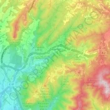
Name: Castellolí topographic map, elevation, terrain.
Location: Castellolí, Anoia, Barcelona, Catalonia, 08719, Spain (41.56558 1.67079 41.62432 1.74609)
Average elevation: 485 m
Minimum elevation: 284 m
Maximum elevation: 753 m
Thank you for supporting this site ❤️
Make a donation
Make a donation
Gear up for your next adventure:
As an Amazon Associate, this site earns from qualifying purchases at no extra cost to you.