
Gemeinde Schottwien topographic map
Interactive map
Click on the map to display elevation.
About this map
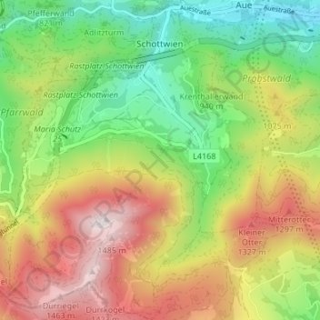
Name: Gemeinde Schottwien topographic map, elevation, terrain.
Average elevation: 941 m
Minimum elevation: 501 m
Maximum elevation: 1,511 m
Other topographic maps
Click on a map to view its topography, its elevation and its terrain.
Klosterwappen
Austria > Lower Austria > Bezirk Neunkirchen > Gemeinde Reichenau an der Rax
A rack-and-pinion railway, the Schneeberg Railway, now over 100 years old, climbs to a height of 1,800 m (5,900 ft), reducing the walk to the summit to an hour or two. There are also a number of other routes for walkers, including from the spa resort of Puchberg am Schneeberg to the east, or from the south, in…
Average elevation: 1,715 m
Sonnleiten
Austria > Lower Austria > Bezirk Neunkirchen > Gemeinde Schwarzau im Gebirge
Average elevation: 872 m