
Ofenpass topographic map
Interactive map
Click on the map to display elevation.
About this map
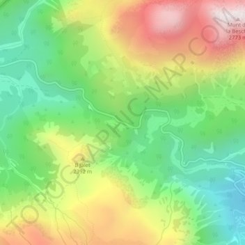
Name: Ofenpass topographic map, elevation, terrain.
Average elevation: 2,225 m
Minimum elevation: 1,847 m
Maximum elevation: 2,750 m
Blick von der Passhöhe nach Nordwesten
Other topographic maps
Click on a map to view its topography, its elevation and its terrain.
Cierfs
Schweiz > Graubünden > Region Unterengadin/Münstertal > Münstertal
Cierfs, Münstertal, Region Unterengadin/Münstertal, Graubünden, 7532, Schweiz
Average elevation: 2,023 m
Santa Maria
Schweiz > Graubünden > Region Unterengadin/Münstertal > Münstertal
Santa Maria, Münstertal, Region Unterengadin/Münstertal, Graubünden, 7536, Schweiz
Average elevation: 1,709 m