
Thank you for supporting this site ❤️
Make a donation
Make a donation
Gear up for your next adventure:
As an Amazon Associate, this site earns from qualifying purchases at no extra cost to you.
Marfil topographic map
Click on the map to display elevation.
Thank you for supporting this site ❤️
Make a donation
Make a donation
Gear up for your next adventure:
As an Amazon Associate, this site earns from qualifying purchases at no extra cost to you.
About this map
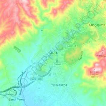
Name: Marfil topographic map, elevation, terrain.
Location: Marfil, Municipio de Guanajuato, Guanajuato, 36250, Mexico (20.95429 -101.32837 21.03429 -101.24837)
Average elevation: 2,045 m
Minimum elevation: 1,875 m
Maximum elevation: 2,403 m
Thank you for supporting this site ❤️
Make a donation
Make a donation
Gear up for your next adventure:
As an Amazon Associate, this site earns from qualifying purchases at no extra cost to you.