
Thank you for supporting this site ❤️
Make a donation
Make a donation
Gear up for your next adventure:
As an Amazon Associate, this site earns from qualifying purchases at no extra cost to you.
Buchchampeta topographic map
Click on the map to display elevation.
Thank you for supporting this site ❤️
Make a donation
Make a donation
Gear up for your next adventure:
As an Amazon Associate, this site earns from qualifying purchases at no extra cost to you.
About this map
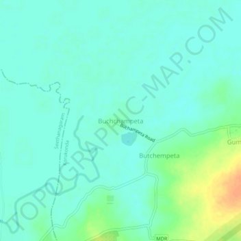
Name: Buchchampeta topographic map, elevation, terrain.
Location: Buchchampeta, Korukonda, East Godavari, Andhra Pradesh, India (17.10311 81.77195 17.14311 81.81195)
Average elevation: 22 m
Minimum elevation: 13 m
Maximum elevation: 48 m
Thank you for supporting this site ❤️
Make a donation
Make a donation
Gear up for your next adventure:
As an Amazon Associate, this site earns from qualifying purchases at no extra cost to you.