
Magacela topographic map
Interactive map
Click on the map to display elevation.
About this map
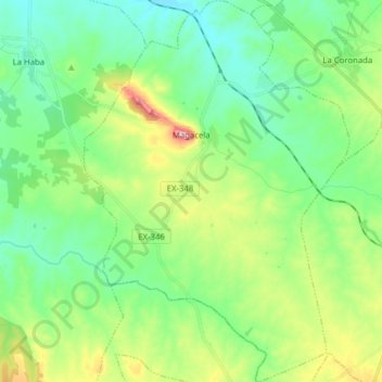
Name: Magacela topographic map, elevation, terrain.
Location: Magacela, Badajoz, Extremadura, 06468, Spain (38.81683 -5.77844 38.93861 -5.66962)
Average elevation: 356 m
Minimum elevation: 280 m
Maximum elevation: 547 m
Other topographic maps
Click on a map to view its topography, its elevation and its terrain.
Castillo de Piedrabuena
Spain > Extremadura > Tierra de Badajoz > San Vicente de Alcántara > Dehesa Piedrabuena
Average elevation: 364 m