Geolocate

Clarkesville topographic map

Click on the map to display elevation.

About this map

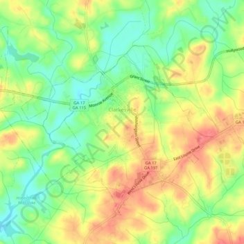
Name: Clarkesville topographic map, elevation, terrain.

Location: Clarkesville, Habersham County, Georgia, United States (34.59363 -83.55716 34.62706 -83.50552)

Average elevation: 418 m

Minimum elevation: 386 m

Maximum elevation: 451 m

Other topographic maps

Click on a map to view its topography, its elevation and its terrain.

Aerial

United States > Georgia > Habersham County

Average elevation: 450 m

Pardue Mill

United States > Georgia > Habersham County

Average elevation: 413 m

Gear up for your next adventure:

🛌Sleeping Mats - Insulated mats for comfortable outdoor sleeping
🧺Ultralight Dry Bags - Organize and waterproof your gear inside your rucksack
🧷Tenacious Repair Tape - Instant fix for torn tents, jackets, or dry bags
🔋Solar Power Banks - Keep your GPS and phone charged during multi-day expeditions
🧭Emergency Beacons - Safety beacons for remote outdoor locations

As an Amazon Associate, this site earns from qualifying purchases at no extra cost to you.