
Thank you for supporting this site ❤️
Make a donation
Make a donation
Gear up for your next adventure:
As an Amazon Associate, this site earns from qualifying purchases at no extra cost to you.
Cauca topographic map
Click on the map to display elevation.
Thank you for supporting this site ❤️
Make a donation
Make a donation
Gear up for your next adventure:
As an Amazon Associate, this site earns from qualifying purchases at no extra cost to you.
About this map
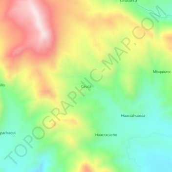
Name: Cauca topographic map, elevation, terrain.
Location: Cauca, Macari, Province of Melgar, Puno, Peru (-14.65290 -70.97191 -14.61290 -70.93191)
Average elevation: 4,405 m
Minimum elevation: 4,176 m
Maximum elevation: 4,716 m
Thank you for supporting this site ❤️
Make a donation
Make a donation
Gear up for your next adventure:
As an Amazon Associate, this site earns from qualifying purchases at no extra cost to you.