
Thank you for supporting this site ❤️
Make a donation
Make a donation
Gear up for your next adventure:
As an Amazon Associate, this site earns from qualifying purchases at no extra cost to you.
Montan topographic map
Click on the map to display elevation.
Thank you for supporting this site ❤️
Make a donation
Make a donation
Gear up for your next adventure:
As an Amazon Associate, this site earns from qualifying purchases at no extra cost to you.
About this map
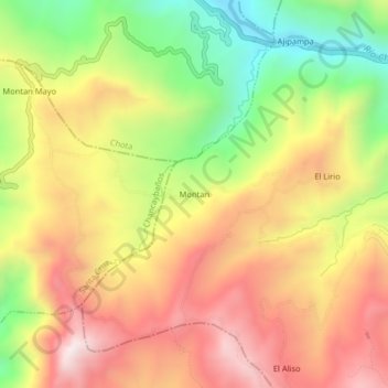
Name: Montan topographic map, elevation, terrain.
Location: Montan, Lajas, Province of Chota, Cajamarca, Peru (-6.58651 -78.79495 -6.54651 -78.75495)
Average elevation: 2,483 m
Minimum elevation: 2,037 m
Maximum elevation: 2,878 m
Thank you for supporting this site ❤️
Make a donation
Make a donation
Gear up for your next adventure:
As an Amazon Associate, this site earns from qualifying purchases at no extra cost to you.