Geolocate

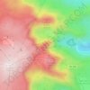
Almeida topographic map

Click on the map to display elevation.

About this map

Name: Almeida topographic map, elevation, terrain.

Location: Almeida, Guarda, Portugal (40.47668 -7.05182 40.78342 -6.79401)

Average elevation: 724 m

Minimum elevation: 468 m

Maximum elevation: 857 m

Other topographic maps

Click on a map to view its topography, its elevation and its terrain.
Serra da Estrela

Portugal > Guarda > Seia

Average elevation: 1,825 m

Castelo Mendo

Portugal > Guarda > Almeida

Average elevation: 722 m

Monteperobolso

Portugal > Guarda > Almeida

Average elevation: 776 m

Aldeia da Serra

Portugal > Guarda > Celorico da Beira

Average elevation: 575 m

Linhares

Portugal > Guarda > Celorico da Beira

Average elevation: 798 m

Cabeças

Portugal > Guarda > Guarda

Average elevation: 833 m

Senhora do Desterro

Portugal > Guarda > Seia

Average elevation: 830 m

São Clemente

Portugal > Guarda > Trancoso

Average elevation: 594 m
A-dos-Ferreiros

Portugal > Guarda > Trancoso > Cótimos

Average elevation: 570 m

Aldeia da Serra

Portugal > Guarda > Celorico da Beira

Average elevation: 575 m

Cântaro Magro

Portugal > Guarda > Manteigas

Average elevation: 1,725 m

Paranhos da Beira

Portugal > Guarda > Seia

Average elevation: 379 m

Castelo Melhor

Portugal > Guarda > Vila Nova de Foz Côa

Average elevation: 391 m

Gear up for your next adventure:

🥾Women's Waterproof Hiking Boots - High-performance trekking boots designed for all-weather comfort
🛑Emergency Bivvy Bags - Heat-reflective survival bags for unexpected nights out
📕Outdoor Navigation Books - Learn traditional and modern navigation techniques
🔋Solar Power Banks - Keep your GPS and phone charged during multi-day expeditions
🧊Personal Water Filters - Drink safely from mountain streams marked on your map

As an Amazon Associate, this site earns from qualifying purchases at no extra cost to you.