Geolocate

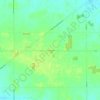
New Riegel topographic map

Click on the map to display elevation.

About this map

Name: New Riegel topographic map, elevation, terrain.

Location: New Riegel, Big Spring Township, Seneca County, Ohio, 55853, United States (41.04682 -83.32462 41.05623 -83.31455)

Average elevation: 252 m

Minimum elevation: 245 m

Maximum elevation: 260 m

Other topographic maps

Click on a map to view its topography, its elevation and its terrain.
Frenchtown

United States > Ohio > Seneca County

Average elevation: 259 m

Gear up for your next adventure:

🧼Camping Hygiene Kits - Compact hygiene essentials for outdoor stays
🧺Microfibre Travel Towels - Fast-drying and compact towels for wild swimming and camping
👖Convertible Hiking Trousers - Versatile zip-off pants for changing mountain weather conditions
🛰️Outdoor GPS Navigation - Navigation devices for remote and off-grid areas
🔋Solar Power Banks - Keep your GPS and phone charged during multi-day expeditions

As an Amazon Associate, this site earns from qualifying purchases at no extra cost to you.