
Covelo topographic map
Interactive map
Click on the map to display elevation.
About this map
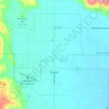
Name: Covelo topographic map, elevation, terrain.
Location: Covelo, Mendocino County, California, 95428, United States (39.78042 -123.28683 39.82439 -123.21033)
Average elevation: 440 m
Minimum elevation: 407 m
Maximum elevation: 673 m
Covelo (/ˈkoʊvəloʊ/ KOH-və-loh) is a census-designated place (CDP) in Mendocino County, California, United States. Covelo is located 14 miles (23 km) east-northeast of Laytonville, at an elevation of 1,398 feet (426 m). The population was 1,394 at the 2020 census, up from 1,255 at the 2010 census. 405 acres (1.64 km2) of Covelo is part of the Round Valley Indian Reservation.