
Daïra Beni Haoua topographic map
Interactive map
Click on the map to display elevation.
About this map
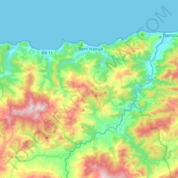
Name: Daïra Beni Haoua topographic map, elevation, terrain.
Location: Daïra Beni Haoua, Chlef, 02017, RADP (36.39658 1.39604 36.55563 1.69466)
Average elevation: 317 m
Minimum elevation: -1 m
Maximum elevation: 1,129 m
Other topographic maps
Click on a map to view its topography, its elevation and its terrain.