
Make a donation
Gear up for your next adventure:
As an Amazon Associate, this site earns from qualifying purchases at no extra cost to you.
Frasco topographic map
Click on the map to display elevation.
Make a donation
Gear up for your next adventure:
As an Amazon Associate, this site earns from qualifying purchases at no extra cost to you.
Frasco
The village is located in the Locarno district. It consists of the village of Frasco and multiple scattered settlements along the road in the upper Verzasca valley. The average elevation of the settlements is about 880 meters (2,890 ft).
Make a donation
Gear up for your next adventure:
As an Amazon Associate, this site earns from qualifying purchases at no extra cost to you.
About this map
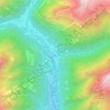
Name: Frasco topographic map, elevation, terrain.
Average elevation: 1,393 m
Minimum elevation: 794 m
Maximum elevation: 2,450 m
Make a donation
Gear up for your next adventure:
As an Amazon Associate, this site earns from qualifying purchases at no extra cost to you.