Geolocate

Paco topographic map

Click on the map to display elevation.

About this map

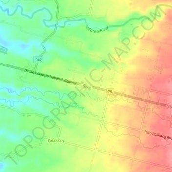
Name: Paco topographic map, elevation, terrain.

Location: Paco, Kidapawan, North Cotabato, Soccsksargen, Philippines (7.01500 125.01787 7.05500 125.05787)

Average elevation: 136 m

Minimum elevation: 93 m

Maximum elevation: 180 m

Gear up for your next adventure:

🚲Cycling GPS Computers - Track elevation and topographic routes on two wheels
🥾Hiking Boot Waterproofing Wax - Maintain the lifespan of your leather trekking boots
🔦LED Camping Lanterns - Illumination for reading maps inside your tent at night
🩹Hiking First Aid Kits - Compact medical kits tailored for trail injuries and emergencies
🥄Titanium Camping Sporks - The ultimate lightweight utensil for trail meals

As an Amazon Associate, this site earns from qualifying purchases at no extra cost to you.