Geolocate

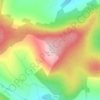
Ballon topographic map

Click on the map to display elevation.

About this map

Name: Ballon topographic map, elevation, terrain.

Location: Ballon, The Municipal District of Tullow, County Carlow, Leinster, Ireland (52.73370 -6.78723 52.74716 -6.76235)

Average elevation: 83 m

Minimum elevation: 67 m

Maximum elevation: 127 m

Other topographic maps

Click on a map to view its topography, its elevation and its terrain.

Borris

Ireland > County Carlow

Average elevation: 60 m

Greenoge

Ireland > County Carlow

Average elevation: 272 m

Slievebawn

Ireland > County Carlow

Average elevation: 315 m

Tinryland

Ireland > County Carlow

Average elevation: 72 m

Ardattin

Ireland > County Carlow

Average elevation: 83 m

Blackstairs Mountain

Ireland > County Carlow

Average elevation: 429 m

Coolnamara Cross Roads

Ireland > County Carlow

Average elevation: 65 m

Borris

Ireland > County Carlow

Average elevation: 60 m

Borris

Ireland > County Carlow

Average elevation: 60 m

Gear up for your next adventure:

🧘Folding Sit Mats - Dry and warm seat for map-reading breaks on damp ground
🧣Fleece Neck Warmers - Extra insulation for winter topographic surveys
🥄Titanium Camping Sporks - The ultimate lightweight utensil for trail meals
🔦Keychain LED Torches - Emergency backup light for finding gear in your pack
📐Altimeters & Barometers - Tools for measuring altitude and air pressure

As an Amazon Associate, this site earns from qualifying purchases at no extra cost to you.