
Tozeur topographic map
Interactive map
Click on the map to display elevation.
About this map
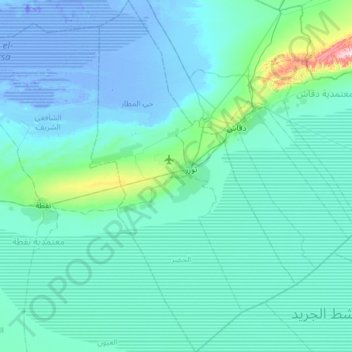
Name: Tozeur topographic map, elevation, terrain.
Location: Tozeur, Tunisie (33.66011 7.96052 34.16607 8.31776)
Average elevation: 28 m
Minimum elevation: -32 m
Maximum elevation: 433 m
Other topographic maps
Click on a map to view its topography, its elevation and its terrain.