Geolocate

Kargal topographic map

Click on the map to display elevation.

About this map

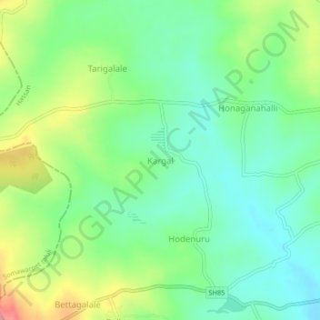
Name: Kargal topographic map, elevation, terrain.

Location: Kargal, Arakalagudu taluk, Hassan, Karnataka, India (12.60729 75.94132 12.64729 75.98132)

Average elevation: 879 m

Minimum elevation: 838 m

Maximum elevation: 959 m

Gear up for your next adventure:

🗺️Scratch-off Peak Maps - Track your progress climbing Munros or Wainwrights
🧘Folding Sit Mats - Dry and warm seat for map-reading breaks on damp ground
Camping Shelters - Emergency and lightweight shelters for outdoor use
🧊Personal Water Filters - Drink safely from mountain streams marked on your map
🎒Hiking Child Carriers - Explore the outdoors with the whole family safely

As an Amazon Associate, this site earns from qualifying purchases at no extra cost to you.