
Thank you for supporting this site ❤️
Make a donation
Make a donation
Gear up for your next adventure:
As an Amazon Associate, this site earns from qualifying purchases at no extra cost to you.
Jilili topographic map
Click on the map to display elevation.
Thank you for supporting this site ❤️
Make a donation
Make a donation
Gear up for your next adventure:
As an Amazon Associate, this site earns from qualifying purchases at no extra cost to you.
About this map
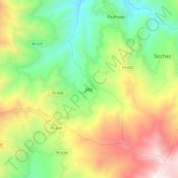
Name: Jilili topographic map, elevation, terrain.
Location: Jilili, Jililí, Province of Ayabaca, Piura, Peru (-4.62500 -79.83716 -4.54500 -79.75716)
Average elevation: 1,561 m
Minimum elevation: 801 m
Maximum elevation: 2,655 m
Thank you for supporting this site ❤️
Make a donation
Make a donation
Gear up for your next adventure:
As an Amazon Associate, this site earns from qualifying purchases at no extra cost to you.