Geolocate

Childers topographic map

Click on the map to display elevation.

About this map

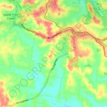
Name: Childers topographic map, elevation, terrain.

Location: Childers, Bundaberg Region, Queensland, 4660, Australia (-25.27768 152.24054 -25.21595 152.29651)

Average elevation: 81 m

Minimum elevation: 44 m

Maximum elevation: 132 m

Gear up for your next adventure:

🍲Portable Camping Stoves - Fast-boiling stoves for hot meals on remote topographic survey trips
🔭Compact Hiking Binoculars - Lightweight optics for scouting terrain and spotting wildlife
🚲Bikepacking Frame Bags - Storage for tools and navigation gear on long off-road rides
🧊Personal Water Filters - Drink safely from mountain streams marked on your map
🐕Hiking Dog Harnesses - Rugged harnesses for taking your companion on mountain trails

As an Amazon Associate, this site earns from qualifying purchases at no extra cost to you.