
Tregaron topographic map
Click on the map to display elevation.
About this map
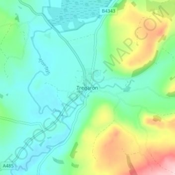
Name: Tregaron topographic map, elevation, terrain.
Location: Tregaron, Ceredigion, Wales, SY25 6HH, United Kingdom (52.18003 -3.97428 52.26003 -3.89428)
Average elevation: 245 m
Minimum elevation: 132 m
Maximum elevation: 497 m
Ceredigion trails, hiking, mountain biking, running and outdoor activities
Other topographic maps
Click on a map to view its topography, its elevation and its terrain.
Newcastle Emlyn Castle
United Kingdom > Wales > Ceredigion > Adpar > Bryndioddef
Average elevation: 78 m