
Ham-Nord topographic map
Interactive map
Click on the map to display elevation.
About this map
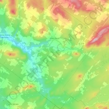
Name: Ham-Nord topographic map, elevation, terrain.
Average elevation: 352 m
Minimum elevation: 199 m
Maximum elevation: 621 m
Other topographic maps
Click on a map to view its topography, its elevation and its terrain.
Victoriaville
Canada > Québec > Arthabaska > Victoriaville
Victoriaville, Arthabaska, Centre-du-Québec, Québec, Canada
Average elevation: 146 m