
Samarina topographic map
Click on the map to display elevation.
Samarina
Samarina is located on an eastern spur of Mount Smolikas, the highest of the Pindus range and the second-highest mountain in all of Greece. At an altitude of 1380–1515 meters (4528' to 4970'), it is considered one of the highest villages in Greece and also one of the highest in the Balkans; its height puts it among soaring settlements such as: Aetomilitsa (Densko) and Seli (Selia).
About this map
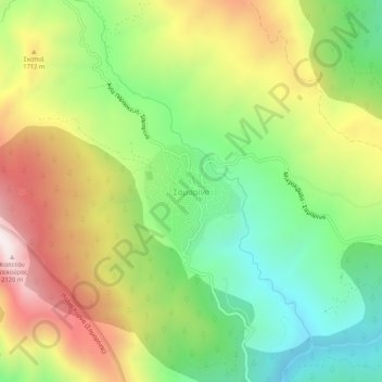
Name: Samarina topographic map, elevation, terrain.
Average elevation: 1,558 m
Minimum elevation: 1,158 m
Maximum elevation: 2,092 m
Other topographic maps
Click on a map to view its topography, its elevation and its terrain.
Municipality of Grevena
Greece > Epirus and Western Macedonia > Grevena Regional Unit
Average elevation: 878 m