
Reichardtswerben topographic map
Interactive map
Click on the map to display elevation.
About this map
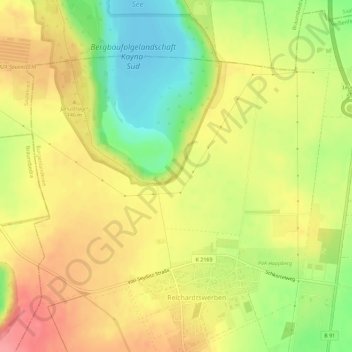
Name: Reichardtswerben topographic map, elevation, terrain.
Average elevation: 138 m
Minimum elevation: 92 m
Maximum elevation: 175 m
Other topographic maps
Click on a map to view its topography, its elevation and its terrain.
Saale
Deutschland > Sachsen-Anhalt > Burgenlandkreis > Weißenfels
Saale, Neustadt, Weißenfels, Burgenlandkreis, Sachsen-Anhalt, 06667, Deutschland
Average elevation: 118 m
Uichteritz
Deutschland > Sachsen-Anhalt > Burgenlandkreis > Weißenfels
Markwerben, Uichteritz, Weißenfels, Burgenlandkreis, Sachsen-Anhalt, Deutschland
Average elevation: 131 m
Uichteritz
Deutschland > Sachsen-Anhalt > Burgenlandkreis > Weißenfels > Lobitzsch
Uichteritz, Lobitzsch, Weißenfels, Burgenlandkreis, Sachsen-Anhalt, Deutschland
Average elevation: 129 m