
Brazzaville (municipality) topographic map
Interactive map
Click on the map to display elevation.
Brazzaville (municipality)
Brazzaville is 506 km (314 mi) inland from the Atlantic Ocean and approximately 474 km (295 mi) south of the equator. Around the city are large plains. The town is relatively flat, and situated at an altitude of 317 m (1,040 ft). Downriver the Congo has numerous rapids, known as Livingston Falls, preventing navigation upriver to this point from its mouth at the Atlantic.
About this map
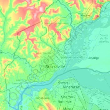
Name: Brazzaville (municipality) topographic map, elevation, terrain.
Location: Brazzaville (municipality), Brazzaville, Congo-Brazzaville (-4.38105 15.13895 -4.09677 15.32480)
Average elevation: 319 m
Minimum elevation: 246 m
Maximum elevation: 576 m
Other topographic maps
Click on a map to view its topography, its elevation and its terrain.