
Chelora topographic map
Interactive map
Click on the map to display elevation.
About this map
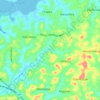
Name: Chelora topographic map, elevation, terrain.
Location: Chelora, Kannur, Kannur district, Kerala, 670006, India (11.85759 75.39198 11.92390 75.44962)
Average elevation: 24 m
Minimum elevation: -5 m
Maximum elevation: 80 m