
Darenth topographic map
Interactive map
Click on the map to display elevation.
About this map
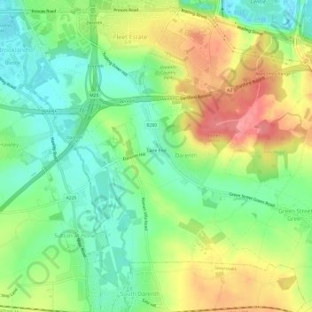
Name: Darenth topographic map, elevation, terrain.
Location: Darenth, Dartford, Kent, England, United Kingdom (51.40286 0.23271 51.43808 0.29266)
Average elevation: 40 m
Minimum elevation: 4 m
Maximum elevation: 90 m
Kent trails, hiking, mountain biking, running and outdoor activities
Other topographic maps
Click on a map to view its topography, its elevation and its terrain.