
Kaplice topographic map
Interactive map
Click on the map to display elevation.
Kaplice
Kaplice is located about 15 kilometres (9 mi) southeast of Český Krumlov and 25 km (16 mi) south of České Budějovice. It is situated on the Malše river. It lies in the Gratzen Foothills. The highest point of the municipal territory is the hill Hradišťský vrch with an altitude of 780 metres (2,560 ft). There are several ponds in the territory.
About this map
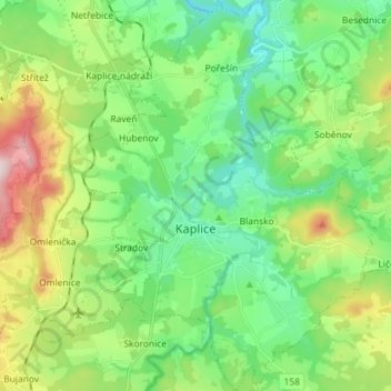
Name: Kaplice topographic map, elevation, terrain.
Average elevation: 611 m
Minimum elevation: 482 m
Maximum elevation: 906 m
Other topographic maps
Click on a map to view its topography, its elevation and its terrain.