
Valdreu topographic map
Interactive map
Click on the map to display elevation.
About this map
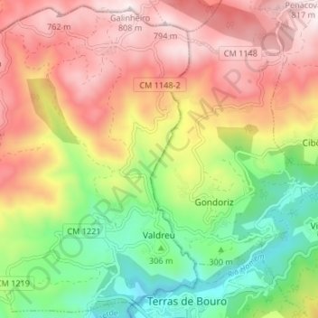
Name: Valdreu topographic map, elevation, terrain.
Location: Valdreu, Vila Verde, Braga, Cávado, Norte, Portugal (41.71726 -8.37248 41.76498 -8.30619)
Average elevation: 434 m
Minimum elevation: 73 m
Maximum elevation: 798 m