
Rivière Saint-François topographic map
Interactive map
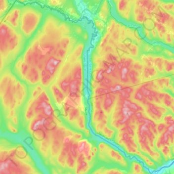
Click on the map to display elevation.
About this map
Name: Rivière Saint-François topographic map, elevation, terrain.
Average elevation: 326 m
Minimum elevation: 157 m
Maximum elevation: 539 m
Other topographic maps
Click on a map to view its topography, its elevation and its terrain.
Rivière Saint-François
États-Unis d'Amérique > Maine > Aroostook County
Rivière Saint-François, Aroostook County, Maine, États-Unis d'Amérique
Average elevation: 344 m