
Turiya topographic map
Interactive map
Click on the map to display elevation.
About this map
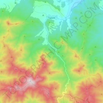
Name: Turiya topographic map, elevation, terrain.
Location: Turiya, Pavel Bania, Stara Zagora, Bulgaria (42.48470 25.11368 42.59092 25.25220)
Average elevation: 702 m
Minimum elevation: 405 m
Maximum elevation: 1,233 m