Geolocate

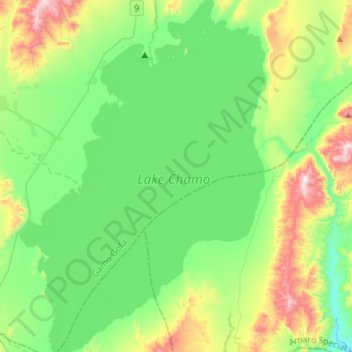
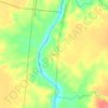
Lake Chamo topographic map

Click on the map to display elevation.

Lake Chamo

Lake Chamo (Amharic: ቻሞ ሐይቅ) is a lake in the Southern Nations, Nationalities, and Peoples' Region of southern Ethiopia. Located in the Main Ethiopian Rift, it is at an elevation of 1,110 meters. The Chamo lake is just to the south of Lake Abaya and the city of Arba Minch, east of the Guge Mountains, and west of the Amaro Mountains.

Wikipedia (CC-BY-SA 3.0)

About this map

Name: Lake Chamo topographic map, elevation, terrain.

Location: Lake Chamo, Gamo Gofa, Southern Nations, Nationalities, and Peoples, Ethiopia (5.69877 37.44987 5.97193 37.63950)

Average elevation: 1,185 m

Minimum elevation: 961 m

Maximum elevation: 1,750 m

Other topographic maps

Click on a map to view its topography, its elevation and its terrain.

Gear up for your next adventure:

🥤Hiking Water Bottles - Reusable bottles for hydration on the trail
🥼Base Layers - Thermal base layers for temperature regulation
💧Hydration Reservoirs - Convenient water bladders for hands-free drinking on the move
🧢Waterproof Hiking Hats - Keep the rain off your face while studying topographic maps
🧊Personal Water Filters - Drink safely from mountain streams marked on your map

As an Amazon Associate, this site earns from qualifying purchases at no extra cost to you.