
Saint-Martin topographic map
Interactive map
Click on the map to display elevation.
About this map
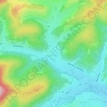
Name: Saint-Martin topographic map, elevation, terrain.
Average elevation: 366 m
Minimum elevation: 262 m
Maximum elevation: 604 m
Other topographic maps
Click on a map to view its topography, its elevation and its terrain.
Quartier des Aviateurs
France > Grand Est > Bas-Rhin > Sélestat > Quartier des Aviateurs
Average elevation: 175 m