
Larochette topographic map
Interactive map
Click on the map to display elevation.
About this map
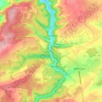
Name: Larochette topographic map, elevation, terrain.
Location: Larochette, Canton Mersch, Luxembourg (49.75711 6.15805 49.80180 6.23558)
Average elevation: 354 m
Minimum elevation: 259 m
Maximum elevation: 425 m