
Tolna topographic map
Interactive map
Click on the map to display elevation.
About this map
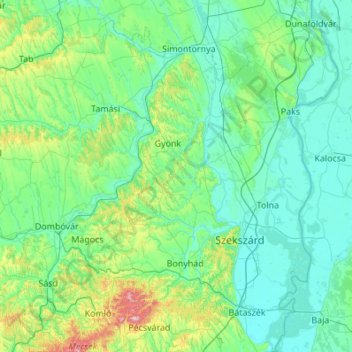
Name: Tolna topographic map, elevation, terrain.
Location: Tolna, Southern Transdanubia, Transdanubia, Hungary (46.10848 18.00174 46.86034 19.00653)
Average elevation: 151 m
Minimum elevation: 82 m
Maximum elevation: 653 m
Other topographic maps
Click on a map to view its topography, its elevation and its terrain.
Dunaföldvár
Dunaföldvár, Paksi járás, Tolna, Southern Transdanubia, Transdanubia, Hungary
Average elevation: 116 m