

Changji topographic map
Click on the map to display elevation.
Changji
Surface water includes glaciers, snowmelt, rivers, springs, lakes, reservoirs, and irrigation channels. Glaciers and perennial snow cover mirror altitudes above 3,800 m—present in all counties except Mulei, serving as “natural reservoirs” for runoff. The basin's rivers are short and reliant on mountain sources; most do not reach the sea, except the Manas River, which terminates in Manas Lake. Notable lakes include Tianchi in the Tian Shan range and Dongdaohaizi on the desert fringe of Mìquan County.
About this map
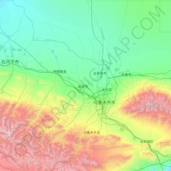
Name: Changji topographic map, elevation, terrain.
Average elevation: 1,309 m
Minimum elevation: 339 m
Maximum elevation: 5,260 m