Geolocate

Sendai Castle topographic map

Click on the map to display elevation.

About this map

Name: Sendai Castle topographic map, elevation, terrain.

Location: Sendai Castle, 仙台城跡線, Kawauchi, Aoba Ward, Sendai, Miyagi Prefecture, 980-0862, Japan (38.25145 140.85481 38.25391 140.85715)

Average elevation: 83 m

Minimum elevation: 17 m

Maximum elevation: 170 m

Other topographic maps

Click on a map to view its topography, its elevation and its terrain.
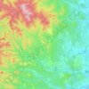
Aoba Ward

Japan > Sendai

Average elevation: 117 m

Aoba Ward

Japan > Sendai

Average elevation: 117 m

Gear up for your next adventure:

👕Technical Hiking Tees - Moisture-management for high-exertion climbs
🧭Emergency Beacons - Safety beacons for remote outdoor locations
🥤Collapsible Water Bottles - Save space in your rucksack as you consume your water
📦Compression Sacks - Reduce backpack volume efficiently
🧊Insulated Flasks - Keeps drinks hot or cold during hikes

As an Amazon Associate, this site earns from qualifying purchases at no extra cost to you.