Geolocate

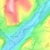
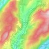
Banwen topographic map

Click on the map to display elevation.

About this map

Name: Banwen topographic map, elevation, terrain.

Location: Banwen, Onllwyn, Neath Port Talbot, Wales, SA10 9LH, United Kingdom (51.75449 -3.68114 51.79449 -3.64114)

Average elevation: 274 m

Minimum elevation: 174 m

Maximum elevation: 479 m

Other topographic maps

Click on a map to view its topography, its elevation and its terrain.
River Neath

United Kingdom > Wales > Neath Port Talbot > Resolven

Average elevation: 272 m

Glynneath

United Kingdom > Wales > Neath Port Talbot

Average elevation: 246 m

Cilybebyll

United Kingdom > Wales > Neath Port Talbot > Gellinudd

Average elevation: 179 m

Pelenna

United Kingdom > Wales > Neath Port Talbot

Average elevation: 217 m

Crynant

United Kingdom > Wales > Neath Port Talbot

Average elevation: 232 m

Neath

United Kingdom > Wales > Neath Port Talbot

Average elevation: 71 m

Pontardawe

United Kingdom > Wales > Neath Port Talbot

Average elevation: 180 m

Port Talbot

United Kingdom > Wales > Neath Port Talbot

Average elevation: 64 m

Neath

United Kingdom > Wales > Neath Port Talbot

Average elevation: 71 m

Gear up for your next adventure:

🧣Fleece Neck Warmers - Extra insulation for winter topographic surveys
🧗Locking Carabiners - Secure gear to your pack or for light technical use
📦Dry Bags - Waterproof bags to protect gear from rain
🎒Hiking Daypacks - Compact backpacks ideal for short hikes and excursions
📱Phone Mounts for Hiking - Secure mounts to carry your phone on trails

As an Amazon Associate, this site earns from qualifying purchases at no extra cost to you.