
Mesetas topographic map
Interactive map
Click on the map to display elevation.
About this map
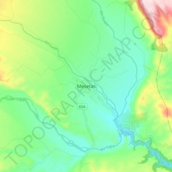
Name: Mesetas topographic map, elevation, terrain.
Location: Mesetas, Meta, Colombia (3.34403 -74.08387 3.42403 -74.00387)
Average elevation: 582 m
Minimum elevation: 476 m
Maximum elevation: 824 m
Other topographic maps
Click on a map to view its topography, its elevation and its terrain.