
Glen Eyrie topographic map
Interactive map
Click on the map to display elevation.
About this map
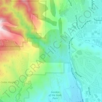
Name: Glen Eyrie topographic map, elevation, terrain.
Location: Glen Eyrie, El Paso County, Colorado, 80829, USA (38.87166 -104.90442 38.91166 -104.86442)
Average elevation: 2,091 m
Minimum elevation: 1,913 m
Maximum elevation: 2,478 m