Geolocate

Okuma topographic map

Click on the map to display elevation.

About this map
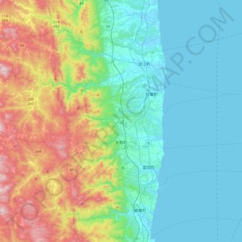
Name: Okuma topographic map, elevation, terrain.

Location: Okuma, Futaba County, Fukushima Prefecture, Japan (37.37208 140.85370 37.45020 141.29444)

Average elevation: 224 m

Minimum elevation: -1 m

Maximum elevation: 870 m

Gear up for your next adventure:

🦟Anti-Midge & Tick Repellent - Vital for hiking in the Scottish Highlands during summer
🧢Thermal Beanie Hats - Prevent heat loss from the head in windy summit conditions
🧣Neck Gaiters - Versatile protection against wind and cold
📐Altimeters & Barometers - Tools for measuring altitude and air pressure
🔦Keychain LED Torches - Emergency backup light for finding gear in your pack

As an Amazon Associate, this site earns from qualifying purchases at no extra cost to you.