Geolocate

Woking topographic map

Click on the map to display elevation.

About this map
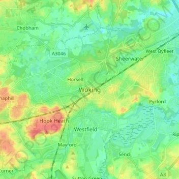
Name: Woking topographic map, elevation, terrain.

Location: Woking, Surrey, England, GU21 6HX, United Kingdom (51.28019 -0.59647 51.36019 -0.51647)

Average elevation: 32 m

Minimum elevation: 14 m

Maximum elevation: 69 m

Surrey trails, hiking, mountain biking, running and outdoor activities

Gear up for your next adventure:

🛌Insulated Sleeping Mats - Crucial thermal protection when sleeping on cold, uneven ground
🧰Survival Kits - Emergency tools for remote environments
🛌Sleeping Bags - Warm and packable sleeping bags for outdoor nights
🧤Waterproof Overmitts - Extreme weather protection for hikers and mountaineers
🧥Packable Down Jackets - Lightweight warmth that compresses small in your bag

As an Amazon Associate, this site earns from qualifying purchases at no extra cost to you.