Geolocate

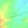
Katrabai topographic map

Click on the map to display elevation.

About this map

Name: Katrabai topographic map, elevation, terrain.

Location: Katrabai, Akola, Ahilyanagar District, Maharashtra, India (19.48363 73.71283 19.48373 73.71293)

Average elevation: 1,039 m

Minimum elevation: 454 m

Maximum elevation: 1,403 m

Other topographic maps

Click on a map to view its topography, its elevation and its terrain.

Kothari

India > Maharashtra > Akola

Average elevation: 299 m

Umerkhed

India > Maharashtra > Akola

Average elevation: 284 m

Nizampur

India > Maharashtra > Akola

Average elevation: 280 m

Hingna Barling

India > Maharashtra > Akola

Average elevation: 286 m

Nawakheda

India > Maharashtra > Akola

Average elevation: 270 m

Pahadpur

India > Maharashtra > Akola

Average elevation: 299 m

Dongargaon

India > Maharashtra > Akola > Dongargaon

Average elevation: 294 m

Babhulgaon

India > Maharashtra > Akola > Babhulgaon

Average elevation: 294 m

Borgaon Manju

India > Maharashtra > Akola

Average elevation: 295 m

Gear up for your next adventure:

⌚GPS Outdoor Watches - Watches with GPS tracking for hiking and exploration
🧦Merino Wool Hiking Socks - Moisture-wicking socks to prevent blisters during long mountain walks
👟Men's Trail Running Shoes - Lightweight grip for fast movement over topographic contours
🧼Technical Clothing Wash - Special soap to clean and restore waterproof membranes
📻Hand-Crank Emergency Radios - Stay updated on weather warnings in remote areas

As an Amazon Associate, this site earns from qualifying purchases at no extra cost to you.