Geolocate

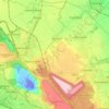
Glesch topographic map

Click on the map to display elevation.

About this map

Name: Glesch topographic map, elevation, terrain.

Location: Glesch, Bergheim, Rhein-Erft-Kreis, North Rhine-Westphalia, 50126, Germany (50.95243 6.57307 50.99243 6.61307)

Average elevation: 68 m

Minimum elevation: 29 m

Maximum elevation: 108 m

Other topographic maps

Click on a map to view its topography, its elevation and its terrain.
Gear up for your next adventure:

📕Outdoor Navigation Books - Learn traditional and modern navigation techniques
🕶️Polarized Sunglasses - Reduces glare from snow and water when reading terrain
🌂Windproof Trekking Umbrellas - Surprising but effective rain protection on low-wind trails
🔥Emergency Fire Starters - Reliable ignition tools for survival situations in damp conditions
👟Men's Trail Running Shoes - Lightweight grip for fast movement over topographic contours

As an Amazon Associate, this site earns from qualifying purchases at no extra cost to you.