
Tassoust topographic map
Interactive map
Click on the map to display elevation.
About this map
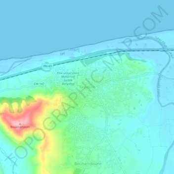
Name: Tassoust topographic map, elevation, terrain.
Location: Tassoust, Emir Abdelkader, Taher District, Jijel, 18038, Algeria (36.78211 5.82260 36.82211 5.86260)
Average elevation: 23 m
Minimum elevation: -2 m
Maximum elevation: 143 m