
Thank you for supporting this site ❤️
Make a donation
Make a donation
Gear up for your next adventure:
As an Amazon Associate, this site earns from qualifying purchases at no extra cost to you.
Bantaawan topographic map
Click on the map to display elevation.
Thank you for supporting this site ❤️
Make a donation
Make a donation
Gear up for your next adventure:
As an Amazon Associate, this site earns from qualifying purchases at no extra cost to you.
About this map
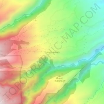
Name: Bantaawan topographic map, elevation, terrain.
Location: Bantaawan, Misamis Oriental, Northern Mindanao, Philippines (8.82243 124.97723 8.86243 125.01723)
Average elevation: 625 m
Minimum elevation: 189 m
Maximum elevation: 1,147 m
Thank you for supporting this site ❤️
Make a donation
Make a donation
Gear up for your next adventure:
As an Amazon Associate, this site earns from qualifying purchases at no extra cost to you.