
Schattdorf topographic map
Interactive map
Click on the map to display elevation.
About this map
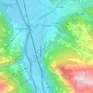
Name: Schattdorf topographic map, elevation, terrain.
Location: Schattdorf, Uri, 6467, Zwitserland (46.82907 8.63135 46.87270 8.71451)
Average elevation: 919 m
Minimum elevation: 439 m
Maximum elevation: 2,408 m