
Ponta Delgada topographic map
Interactive map
Click on the map to display elevation.
About this map
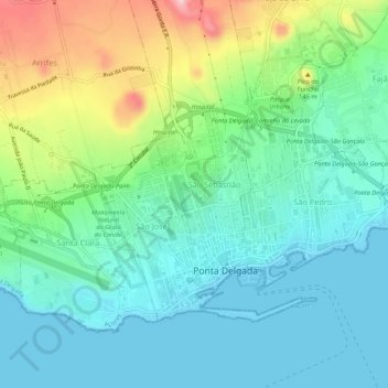
Name: Ponta Delgada topographic map, elevation, terrain.
Location: Ponta Delgada, Azores, Portugal (37.73264 -25.69908 37.76277 -25.64566)
Average elevation: 61 m
Minimum elevation: 0 m
Maximum elevation: 242 m
Other topographic maps
Click on a map to view its topography, its elevation and its terrain.